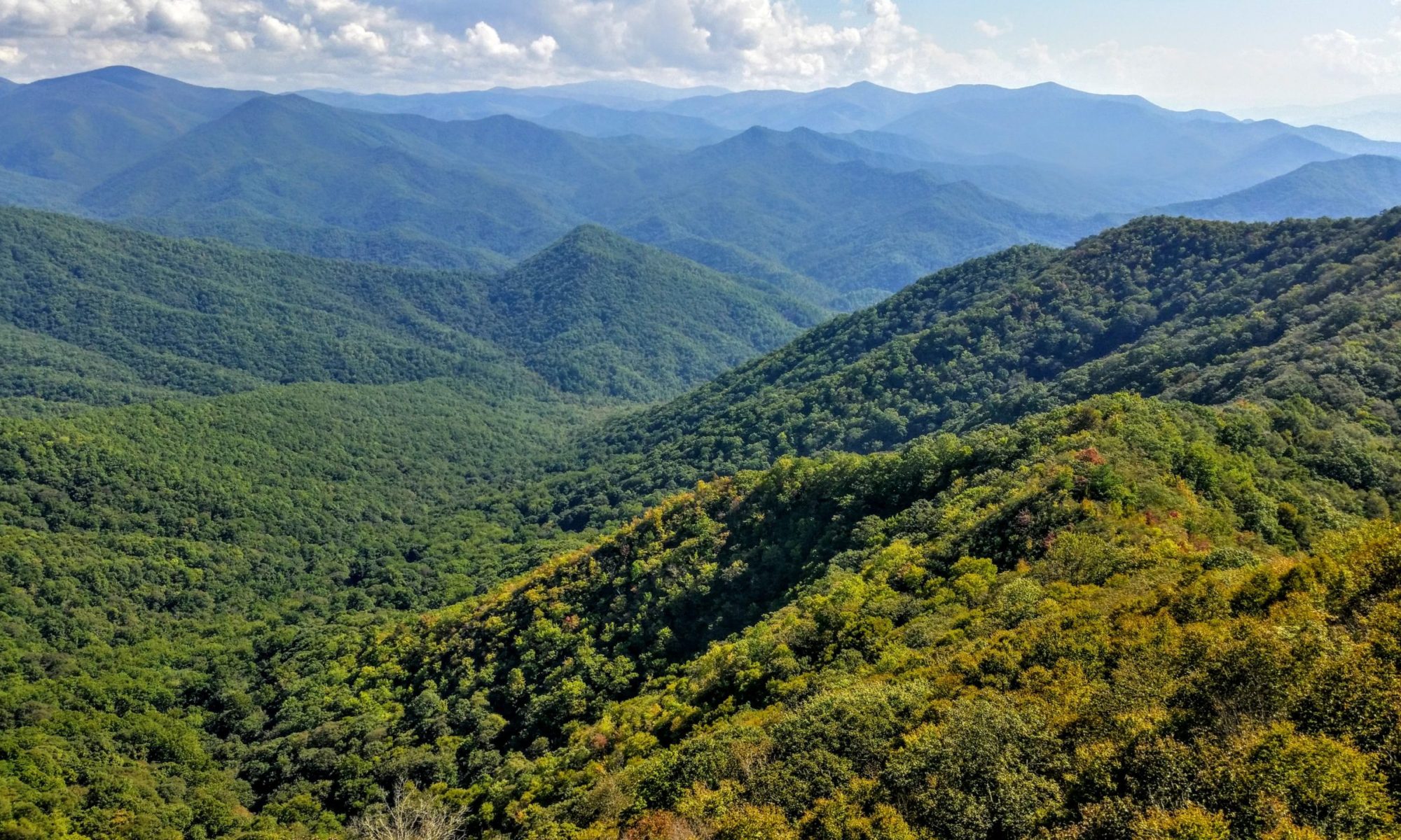
Views from The Jumpoff |
I did not get up and out of the shelter as soon as I would have liked this morning. It rained all night and to sleep on a flat surface in a warm down bag under a solid roof was actually very comfortable. Here’s an Appalachian Trail secret: rain seems to keep the shelter mice away. Also works for shelter moose.
I slowly rolled over and retrieved my stove, made oatmeal and coffee, and eventually packed up to hike the final distance to the car at the Nantahala Outdoor Center. It was 12 miles away, but 8 of those miles were steeply downhill.
Since this would likely be my last day hiking for a while, I boldly broke one of the most sacred rules of the outdoors – I used electronics to play music…out loud! …with no earphones! I know, this is considered to be backcountry sacrilege among the purists, but I was hiking alone and the only others who heard my sonic pollution were south-bounders. They had to endure it for the few seconds required to pass me going the other way, but I still felt their looks of contempt on my twerking backside. As for my choice of music, I downloaded several albums to my phone: ZZ Top, The Eagles, Pink Floyd, and (don’t laugh) the Guardians of the Galaxy: Awesome Mix Soundtrack Vol. I and II. I especially like “Mr. Blue Sky” by ELO, “Brandy” by Looking Glass, and “Surrender” by Cheap Trick. I’ll admit, it is a little awkward to pass someone while playing Parliament’s “Flash Light.”
Also, while it is an excellent album, Bela Fleck & Abigail Washburn’s “If I had a Shotgun” and “Railroad” has just one too many banjos for the backwoods. It felt like hiking through the setting for Deliverance – which, by the way, was filmed nearby near the Georgia/South Carolina border.
The primary landmark for the day was Wesser Bald. This isolated mountain top has a nice observation tower at its peak. But, as I have come to expect, the view was haze and clouds. The midday sun was quickly burning off the fog, but I wanted to get to the car and get home, so I did not stick around.
Past Wesser Bald, the trail follows a series of thin, high ridge segments. At some locations, the trail is only a few feet wide with the terrain dropping down hundreds of feet on both sides. Its almost like walking across a narrow skybridge of earth between anchoring mountains. At one point, the trail seems to simply end at a cliff’s edge. This is called the “jump-off” (or “jump-on” depending on your direction). The path actually continues just past the jump-off cliff down a very steep set of steps and into the thicker forest.
I arrived at the NOC around 2:30 this afternoon. I changed out of my hiking clothes in to jeans and a t-shirt, looked around a bit, and noted where the AT crosses the train tracks and continues uphill. To balance the descent of almost 3000 feet from Wesser to NOC, the trail leaves NOC with an immediate ascent of 3200 feet to the summit of Cheoah Bald. But, fortunately, that is a challenge for another day and another year. The drive back home included a hamburger, fries and cola – traditional post-hike cuisine.
I am just a little disappointed that did not complete my goal of reaching Fontana Dam by the end of 2017. But I did get to the NOC by covering a total of 144 miles within three segment hikes and six months. Add to that all the rain, humidity, the Great Blister Incident, the multiple drives over to the Nantahala region, the transportation logistics, working a full-time job, and appeasing an understanding wife and family, I think hiking from Amicalola State Park to the NOC in one hiking season is a pretty admirable accomplishment. I have now completed about 1/15 of the entire trail. At this rate, I should reach Katahdin in the year 2032. For next year, I am considering the Nolichucky River in Erwin, TN at mile 342 as my goal for 2018. Tune in next year to see how I’m doing!
Doctor Photon